Extreme storm surge expected with Florence
Published 9:03 am Tuesday, September 11, 2018

- (National Weather Service)
Hurricane Florence will bring an extreme storm surge threat to the area.
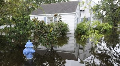
The National Weather Service is now saying that residents should prepare for life-threatening surge having possible devastating impacts across most low lying areas in eastern North Carolina.
A 6 to 12 foot above ground level storm surge, bringing widespread, deep inundation, is forecasted from Cape Fear to Cape Lookout, including the Neuse and Pamlico rivers.
Storm surge maps indicate areas around the Pungo River (Belhaven/Pantego) and various points on both the north and south sides of the the Pamlico River, including Aurora, will see water greater than 3 feet above ground level. As the river narrows, the threat of extreme storm surge grows — maps indicate greater than 9 feet above ground level inundation.
We will know more information after a meeting with Beaufort County Emergency Services at 1 p.m. today.
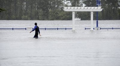
A state of emergency was declared by Beaufort County Board of Commissioners on Monday night. Beaufort County Emergency Services issued a voluntary evacuation on Monday, encouraging any occupant of Beaufort County to seek shelter away from the path of Hurricane Florence.
More Hurricane Stories

SportsPlus
How to Pick the Hurricanes vs. Blue Jackets Game with Odds, Spread, Betting Line and Stats – January 23
Wanting to put some money on the upcoming game (Thursday at 7:00 PM ET) between the Carolina Hurricanes…
Will Seth Jarvis Score a Goal Against the Blue Jackets on January 23?
For people looking to bet on the upcoming matchup between the Carolina Hurricanes and the Columbus Blue Jackets…
Will Andrei Svechnikov Score a Goal Against the Blue Jackets on January 23?
In the upcoming contest versus the Columbus Blue Jackets, which begins at 7:00 PM ET on Thursday, can…
Will Sebastian Aho Score a Goal Against the Blue Jackets on January 23?
Can we expect Sebastian Aho scoring a goal when the Carolina Hurricanes clash with the Columbus Blue Jackets…
Will Martin Necas Score a Goal Against the Blue Jackets on January 23?
The Carolina Hurricanes’ upcoming game against the Columbus Blue Jackets is set for Thursday at 7:00 PM ET.…
-
Polls
 Loading ...
-
-