Tropical Storm Ophelia: Saturday morning update
Published 8:27 am Saturday, September 23, 2023
|
Getting your Trinity Audio player ready...
|
From Chris Newkirk, Beaufort County Emergency Services:
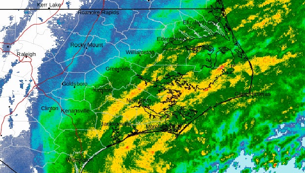
Tropical Storm Ophelia moved a little slower than expected overnight and appears to be taking a slightly more western track across Eastern NC. These developments have changed the timing and locations of our strongest winds. Please see the highlighted item below.
Rain
- Widespread rain is expected to continue through noon today.
Winds
- Winds are beginning to shift to the east and our current wind conditions are expected to continue through 11am. The center of Ophelia is expected to pass along the western edge of our county around 11am, which will cause our winds to transition to the SE, and eventually become SW.
- Our highest winds are expected to occur between 11am and 3pm today.
- Areas along and west of Bath and Blounts Creek should expect to experience sustained winds of 40 to 50 mph with frequent guts of 55 to 65 during this time.
- Areas east to include Aurora, Bayview, Belhaven and Pamlico Beach are now forecasted to receive sustained winds of 25 to 30 mph with frequent gust of 35 to 40.
- Southwest winds will remain sustained between 15 and 20 mph with frequent gust of 20 to 30 mph through midnight Saturday.
Storm Surge
Most of our waterways are currently experiencing 3 to 4 feet of surge. These levels are expected to continue or even slightly increase until our winds shift to the SW around 3pm today.
*For anyone planning to attend ECU’s home opener in Greenville on Saturday, the current game time forecast is as follows:
- Rain chances will begin to diminish around noon, with less than 3 tenths of an inch expected after 2pm.
- Sustained southwest winds between 15 and 20 mph with gust of 20 to 30 mph are expected between 6pm and 10pm.*
We encourage everyone to continue to monitor local media outlets for additional information, as well as any watches and / or warnings that may be issued.


