Major river flooding, life-threatening surge forecasted
Published 11:32 pm Monday, September 10, 2018

The warnings from the National Weather Service continue to grow more dire as Hurricane Florence approaches the Carolina coast.
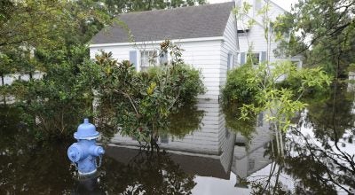
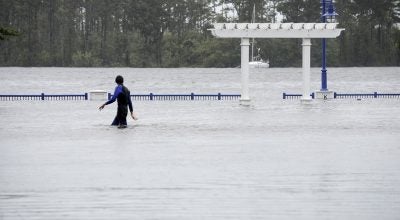
Life-threatening impacts from wind, storm surge and flooding are indicated as the large storm makes landfall from Thursday afternoon to Thursday evening near Wilmington, extending into Friday.
By 5 p.m. Monday, Florence had intensified from a Category 2 to a Category 4 storm over a matter of hours.
At the 11 p.m. update, the National Weather Service said the storm will intensify to near-category 5 strength. There remains high confidence that Florence will be a large and dangerous storm when it makes landfall, regardless of intensity.
A storm surge watch for the South Carolina, North Carolina and Virginia coastlines will likely be issued Tuesday morning. A storm surge of 7 to 9 feet is currently predicted for local waterways.
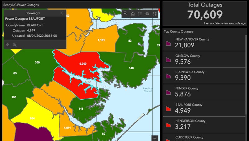
In Beaufort County, the local Board of Commissioners issued a state of emergency Monday night and Emergency Services officials have asked that residents voluntary evacuate the county.
According to Carnie Hedgepeth, director of Beaufort County Emergency Services, those who have the ability to get out of the path of Florence are strongly encouraged to evacuate by sunset on Wednesday.
Tropical storm force winds are expected to arrive in Beaufort County by Wednesday evening. All resident are asked to, if not evacuate, then prepare to shelter in place for at least five days and expect widespread, and perhaps long-term, electrical, communications and infrastructure issues and outages.
The last category 4 hurricane to hit eastern North Carolina was Hurricane Hazel in 1954.
Find hurricane preparation tips here.
More Hurricane Stories

SportsPlus
Buy Tickets for Carolina Hurricanes vs. Minnesota Wild on January 4
Sebastian Aho and Marco Rossi will be two of the top players to keep an eye on when…
How to Watch AAC College Basketball Games – Saturday, January 4
AAC teams will take the court across three games on Saturday’s college basketball schedule. That includes the UTSA…
Andrei Svechnikov Player Prop Bets for the Hurricanes vs. Wild Game – January 4
Andrei Svechnikov will be in action when the Carolina Hurricanes and Minnesota Wild meet on Saturday, January 4,…
Bulls vs. Hornets Tickets Available – Friday, Jan. 17
The Chicago Bulls (15-19) go head to head with the Charlotte Hornets (7-26) at 8:00 PM ET on…
Seth Jarvis Player Prop Bets for the Hurricanes vs. Wild Game – January 4
The Carolina Hurricanes, including Seth Jarvis, will be on the ice Saturday versus the Minnesota Wild at PNC…
-
Polls
 Loading ...
-
-