The ‘perfect Cat. 1’
Published 1:12 am Sunday, September 18, 2011

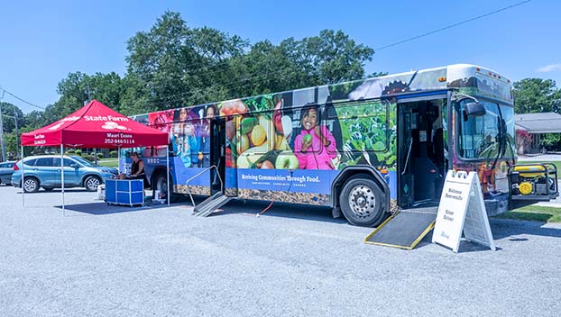
Hurricane Irene’s storm surge nearly demolished this house at Jarvis Landing and destroyed others east of Aurora and north at Pamlico Beach on the Pamlico River. (WDN File Photo/Jonathan Clayborne)
Beaufort County government has no official measurement of the maximum winds Hurricane Irene unleashed on the Washington area as the storm tracked just east of the mouth of the Pamlico River on Aug. 27.
The anemometer, or wind-measuring device, was blown down at Washington’s Warren Field Airport.
But an apparently accurate measurement of Irene’s wind was taken in southeastern Beaufort County, according to John Pack, Beaufort County’s emergency-management coordinator.
PotashCorp’s Aurora phosphate-mining facility has a weather-monitoring station attached to its security building.
The wind measurements Pack cited were taken at this station.
“We were getting sustained winds well over 75 mph,” he said in an interview late last week. “From the reports they gave us, we’re talking in excess of 10 to 15 hours of that.”
Wind gusts of 103 mph were noted, with routine gusts of 90 mph, Pack related.
“They were in the ballpark from what the (National Weather Service) was telling me,” he said.
A final assessment of Irene’s storm surge still wasn’t available by the week’s end.
Pack was awaiting surge reports from officials with the U.S. Geological Survey.
USGS was sending in staff and equipment in an attempt to gain reliable surge estimates, he said.
Pack’s reports showed that it’s believed high watermarks residents are displaying on buildings in Aurora, Pamlico Beach and Schram’s Beach indicate a record surge could be confirmed at some point.
“Belhaven, there are people there that are saying it was higher than anything they had seen by 4 to 6 inches,” he said.
Computer models had predicted surges of 8 feet to 10 feet, Pack pointed out.
But Irene was just a Category 1 storm.
The Saffir-Simpson Scale shows Category 1 hurricanes have winds of 74-95 mph.
Countywide damage assessments still weren’t available nearly three weeks after the hurricane passed, a testament, officials said, to the amount of debris the giant storm left behind.
And, at Irene’s peak, Beaufort County was in the western eyewall, generally considered the weaker flank of a hurricane.
So, why were this hurricane’s effects so extreme?
“It was where the storm went,” Pack explained.
The tropical system’s size, track and the duration of its winds also played significant roles, he said.
As Irene made landfall at Carteret County, it started pumping water from the Pamlico Sound into the Pamlico River, Pack said.
“As it made its move on up (the sound), then it drove that water into the Aurora area,” he observed, adding that water was also shoved up Pamlico Beach and parts of Belhaven.
“That was the key was the duration,” Pack stated. “A Cat. 2 storm coming by quickly will create less damage than what we saw with this Cat. 1. You can have gusts of wind in excess of 75 mph — it can be as high as 105 mph — it’s still only a Cat. 1 storm because of the sustained winds, which is what got us. The sustained winds pounded us for so long.”
As the winds circulating the storm changed direction, trees that had been battered but held their ground in previous gusts began falling all over the county, he said.
And Irene’s bands of rain seemed to “train,” or trek repeatedly, over the same locations.
“People don’t remember sustained (wind) means sustained, and anything over 75 mph, if it’s not tied down, it can only withstand so much beat up,” Pack said. “The slow storms are the ones you fear the most, and it did not speed up the way that they had anticipated a storm, when it comes onshore, does.”
Pack said he’s had repeated conversations with weather-service officials in the days since Irene pummeled eastern North Carolina.
“If you had a storm that you wanted to call a perfect Cat. 1, and you were on the negative side of the word perfect, this was it,” he said.
And he feels fortunate there wasn’t more loss of life in Beaufort County because of Irene.
Unfortunately, there was one in-county death in which Irene was a contributing factor, he related. The death was also tied to a pre-existing medical condition, and emergency crews were delayed in giving assistance because roads were blocked.
It took chainsaw crews an hour and 45 minutes to clear downed trees and open a path to the victim’s home.
“We’re not talking about it a lot because it really hurt the crews that went in there after her,” Pack said. “You can only cut so fast.”
Pack offered the highest possible praise for the county’s first responders, who were at work before, during and long after Irene.
“They’re the unsung heroes, once again,” he said.
More News


-
Polls
 Loading ...
-
-